 Map2Craft
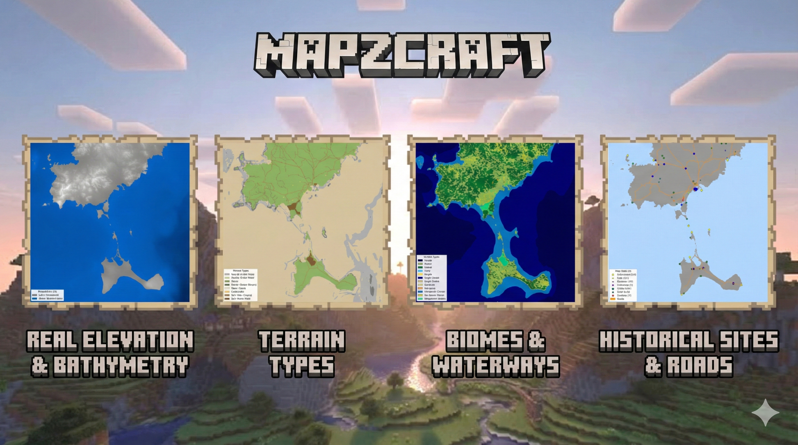
A Python-based toolset for generating realistic Minecraft worlds from real-world geospatial data. This project uses SCons to orchestrate the processing of elevation data, bathymetry, proper land cover mapping, and OpenStreetMap (OSM) features into a WorldPainter-compatible format. Features 🌍 Real-world Terrain & Bathymetry Downloads and processes high-resolution elevation data (SRTM/Copernicus) and reprojects it to meters (EPSG:3857). Bathymetry Merging: Seamlessly blends land elevation with underwater depth data (EMODnet/GEBCO) to create realistic coastlines and ocean floors. Zero-Level Handling: Configurable sea level and masking to prevent shallow coastal artifacts. 🌲 Biomes & Land Cover Uses ESA WorldCover data to automatically map real-world land categories to Minecraft biomes. ...